
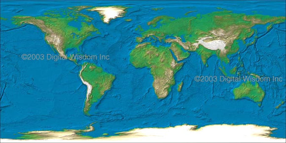
World 4 km Photoshop JPEG Relief map and Illustrator EPS vector map - Cartographic projection
Relief texture World Map at 4 km resolution showing land relief in color variation based on elevation. The map is sized at 10,800 x 5,400 pixels, giving a printed size of 72 x 36 inches at 150 dpi, or 36 x 18 at 300 dpi. This map can be used with the Illustrator EPS vector map shown below to build a composite world map with selectable geo-political features including borders, rivers, citiesfeature names and each individual countries.
World Map prepared in Illustrator EPS and features 200+ fully editable and customizable layers. The map has been prepared with a high level of detail and is fully rescalable when opened in Adobe Illustrator. The map may be used with any of the relief maps shown above to build a composite world relief map with overlying geo-political features. Any layer may be selected, edited for color and thickness or removed to build a map view to your specification.