
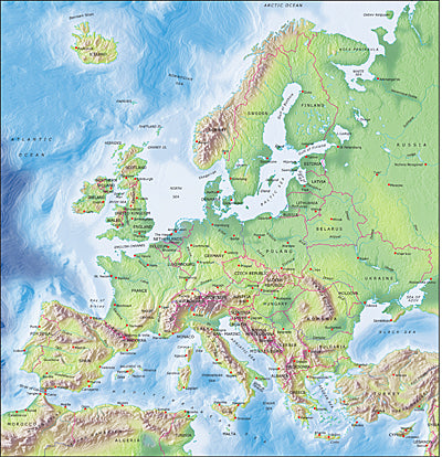


Photoshop JPEG Relief map and Illustrator EPS vector map European EU Countries
Mountain High Relief Map package of Photoshop JPEG and Illustrator EPS map of European EU Countries is a high quality fully editable geopolitical relief and vector map in Azimuthal equidistant projection and is supplied with a comprehensive set of layers of editable features and names. JPEG Relief maps and EPS Vector maps can be easily and quickly loaded into desktop design, publishing, presentation apps for the highest quality geographical representation. At 300 dpi this maps measures 9.56 x 9.94 inches and a pixel size of 2869 x 2983. Map resolution is 1500 meters per pixel.